Along the coasts of East Africa, this Swahili proverb is well known. In the Western Indian Ocean, where seagrass meadows fringe every coastline, this wisdom is the key to regional survival.
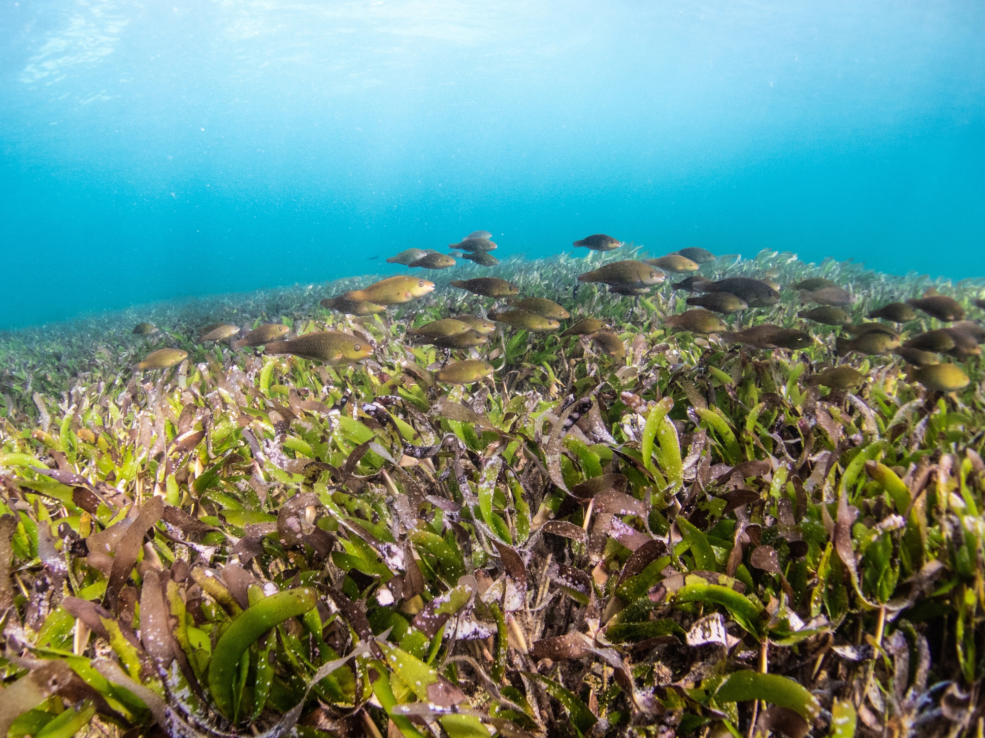
These underwater meadows support roughly one in five fish species that we eat globally, protect our shorelines from erosion, and store vast amounts of carbon in ocean sediments. They support coastal human livelihoods and countless marine creatures, from smaller unassuming macroinvertebrates (bivalves, gastropods, and crabs) to charismatic fauna (dugongs, green sea turtles, and seahorses). Despite these benefits, our region has lacked standardized, field-verified maps of its seagrass ecosystems—a significant barrier to effective conservation and management. As researchers focused on seagrass, we have seen growth in research efforts across the region, but often with varied methods, fragmented data, and findings that rarely reach the policymakers and communities who need them most.
This is why we, a group of researchers from across East Africa, joined the Large-Scale Seagrass Mapping and Management Initiative (LaSMMI), a regional collaboration established in 2024 bringing together research institutions and researchers in Kenya, Madagascar, Mozambique, and Tanzania (including Zanzibar). With LaSMMI we are mapping seagrass meadows and estimating their carbon stock potential. We can then use these maps to inform government efforts to enhance coastal resilience through adaptation and mitigation strategies where coastal wetland ecosystems, like seagrass, play a vital role.
Community Waters, Regional Currents
Along East Africa’s coast, fishing and gleaning communities depend on seagrass meadows for their livelihoods. For generations, they have understood the value of healthy seagrass beds—they are the nurseries where fish grow, the hunting grounds where octopus hide, and the meadows where women and children gather shellfish during low tide. The traditional knowledge, passed down through oral histories and daily practice, represent an invaluable foundation for conservation. They are also a foundational resource of ocean literacy, whereby we understand how we influence the ocean, and the ocean influences us. When elders recall the times when seagrass beds stretched further and shellfish were more abundant, they are documenting ecological change. Their lives are tied to the sea, and knowledge flows from the ocean through generations of fishers and stewards, creating a time-series that complements our science.
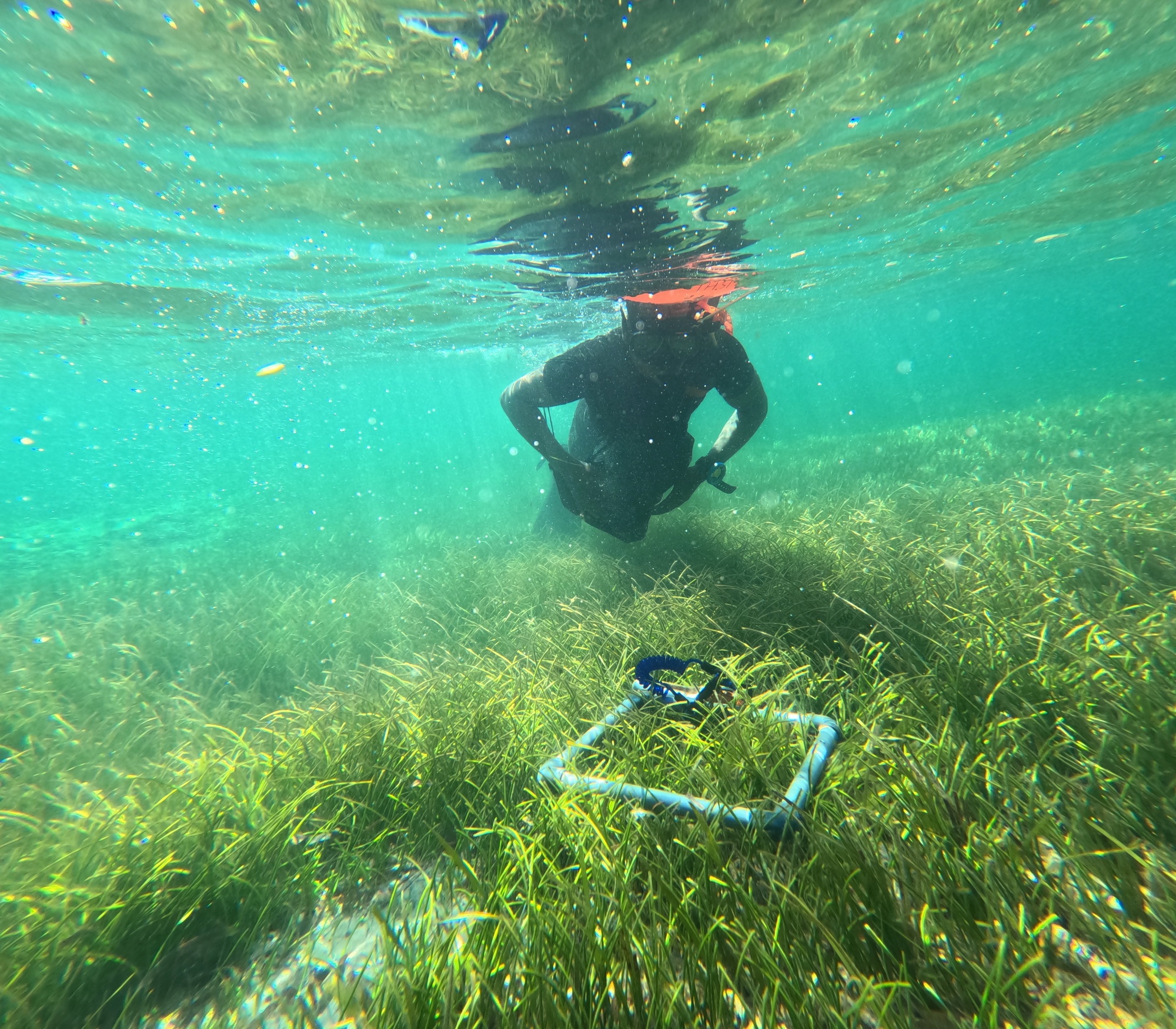
During our surveys, we also see firsthand the changes occurring in seagrass meadows. Across the sites where seagrass remains healthy, canopies dampen wave energy, sediments stay locked in place, and plenty of fish scatter through the blades as we approach. In areas that are degraded, there are more patches of bare sand, and greater algae cover, and fewer schools of fish.
The maps we create will help identify critical habitats, informing a range of management approaches—from national marine protected areas and fisheries regulations to beach management units, locally managed marine areas, and traditional forms of community-based management. When we create maps and document the biomass in these seagrass meadows, we can support their formal recognition. In doing so, we work with communities to extend ocean literacy across groups, policies, and organisations. Management of these areas are grounded in the needs of fishing and gleaning communities and backed by robust science allowing us to prioritize where protection and restoration will deliver the greatest benefits for both people and climate. When we honor this collaboration, it is clear that protecting these lush underwater meadows is not only for the benefit of ecosystem processes, but for the preservation of human histories and futures bound to the coast.
Regional Policy Frameworks
Learning from our neighbours, LaSMMI has been guided by the success of Seychelles, who recently became one of the first nations to create a field-verified seagrass map and estimate its seagrass carbon storage. In Seychelles, seagrass covers around 160,000 hectares, and on average, stores 118 tons of organic carbon per hectare, this is nearly equivalent to the annual emissions from the country's entire energy sector. The Seychelles government has used this data to inform its commitment to protect all seagrass and mangrove ecosystems within managed protected areas by 2030. LaSMMI aims to provide a similar scientific foundation for policy.
In August 2024, the Nairobi Convention, a legally binding regional agreement for Western Indian Ocean nations, adopted decisions urging stronger protection for blue carbon ecosystems and calling for the development of a cohesive regional seagrass strategy. Fragmented policies risk overlooking the interconnectivity of seagrass ecosystems. These seascapes cross geopolitical borders, so the strategies used to protect them must reflect this reality. Ocean currents carry seagrass seeds and nutrients across national borders, fish populations migrate between meadows in different countries, and the carbon stored in one nation's seagrass beds contributes to the climate stability of all. Bound together by our seascapes, we must follow the currents that connect us, guided by the stewardship of those who know these waters best.
Local Hands on the Oars
The health of our seagrass meadows requires local knowledge, involvement, and a shared ocean literacy which comes from the community, rather than the scientists. Too often, international research projects parachute in with predetermined methods and objectives, extracting data and knowledge, swiftly moving on to the next project without adequate returns to or collaborations with the community. Recognizing the power and durability of local stewardship, LaSMMI was conceived differently.
This partnership between The Pew Charitable Trusts, the Western Indian Ocean Marine Science Association, the University of Southampton and research institutions that hold deep knowledge of local ecosystems and longstanding relationships with coastal communities—the Kenya Marine and Fisheries Research Institute, University of Dar es Salaam, State University of Zanzibar, Eduardo Mondlane University, and the University of Toliara's Institute of Fisheries and Marine Sciences.
Our research questions continue to emerge from national priorities, and the data remains with our institutions and governments. Rather than capacity building from scratch, we strengthen our capacity by recognizing and amplifying the expertise that already exists within each country and providing the equipment and tools that are otherwise difficult to access. This design delivers actionable data that national governments can use, and, importantly, that communities can trust.
Through transparency and shared ownership, policy makers see their local researchers and academics developing field observations, mapping data, and carbon assessments. The data becomes a shared resource, a shared language,, serving as a powerful engine for ocean literacy and shining a light on a lesser-known ecosystem so its value becomes universally known.
This knowledge is instrumental to protecting the future of our coasts, which is why LaSMMI is training the next generation of marine scientists across the region. Field campaigns provide hands-on research experience for students from our universities, community members, fisheries and marine park managers, building expertise that will serve our region for decades. This expertise will remain within our countries long after the initiative concludes, empowering future leaders to sustain a cycle of knowledge transfer and ensure the long-term protection of seagrasses.
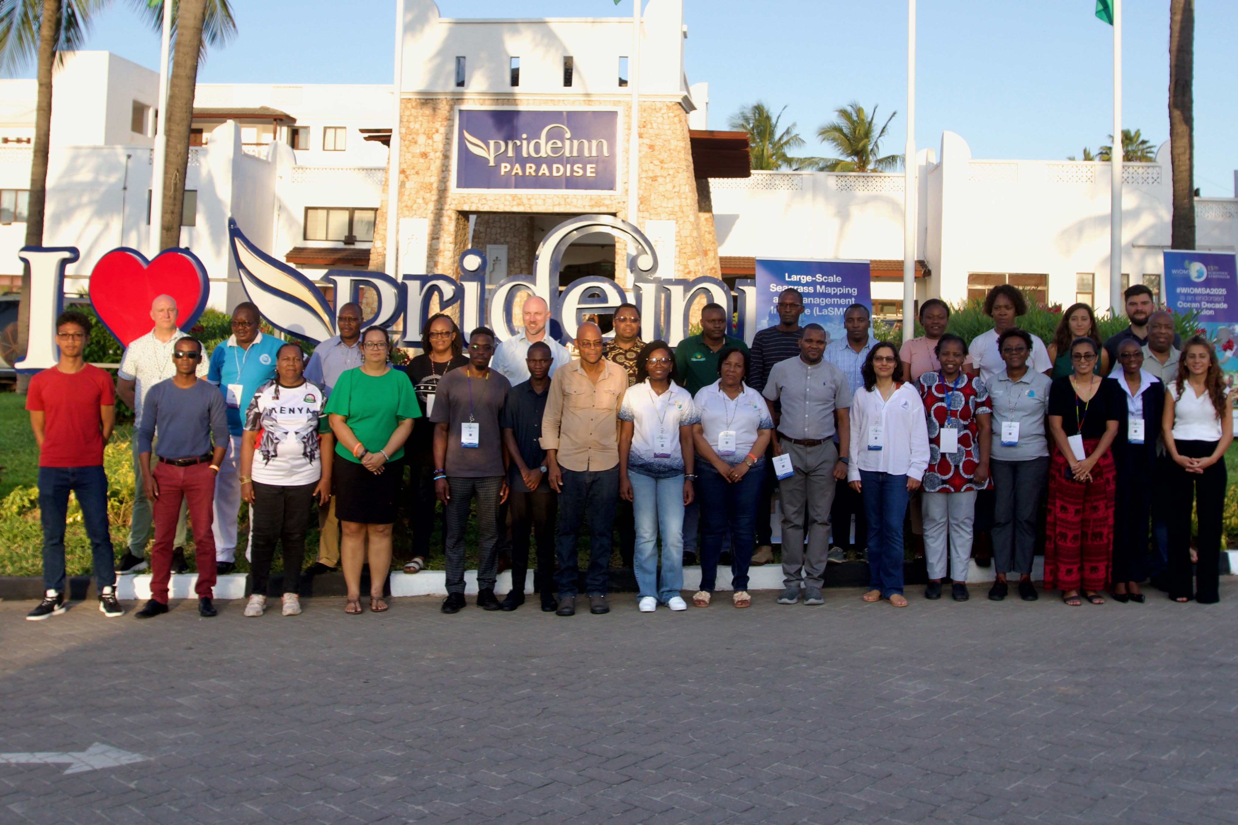
When 35 partners and stakeholders gathered in Zanzibar in October 2024 to launch LaSMMI, we aligned our oars. We agreed on the destination: seagrass maps completed by the end of 2026, with data flowing directly to national governments and regional bodies. Since then, field teams across the region have collected hundreds of data points on seagrass distribution and condition. Satellite imagery analysis is underway, and our first preliminary maps are taking shape.
When researchers, policymakers, and coastal residents row in unison, the boat moves towards a future where the health of the meadows and the prosperity of those who depend on them are navigated together.
Authors
Dr. Salomão Bandeira is an Associate Professor at Eduardo Mondlane University in Mozambique; Dr. Blandina Lugendo is Senior Lecturer and Dean of the School of Aquatic Sciences and Fisheries Technology at the University of Dar es Salaam, Tanzania; Dr. Nirinarisoa Lantoasinoro Ranivoarivelo is a Senior Lecturer at the Institute of Fisheries and Marine Sciences at the University of Toliara in Madagascar; Dr. Jacqueline Uku is a Principal Research Scientist at the Kenya Marine and Fisheries Research Institute; Dr. Ali Ussi is a Senior Lecturer at the Department of Natural Science, State University of Zanzibar.